Emergency decisions are only as good as the information behind them. Weather observations, warnings, maps, crew reports, satellite imagery, resource status and community impacts all need to be collected, checked, interpreted and turned into action.
In business this is often called business intelligence and analytics. Emergency services usually use more specific terms such as Intelligence, situational awareness, common operating picture, Planning, Public Information and lessons management. The idea is similar: turn reliable information into safer, better-timed decisions.
Approach: All hazards
Reviewed: October 2026
For the public: dashboards do not replace official warnings
Maps and apps are useful, but information can be delayed, incomplete or misunderstood. During an emergency, use current warnings from the responsible emergency authority and follow the action statement in the warning. If life is in immediate danger, call Triple Zero (000).
What does “business intelligence” mean in emergency management?
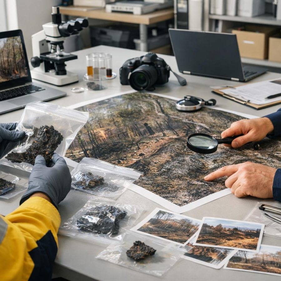
Business intelligence usually means collecting information from different sources, organising it, analysing it and presenting it in a form that supports decisions. The emergency-management equivalent may include a map of active incidents, weather observations, road closures, resource locations, forecasts, intelligence reports, damage information and public warnings.
However, emergency services do not normally describe every operational information process as “business intelligence”. Under AIIMS 2025, the more accurate language includes Intelligence, Planning, Public Information and the development of a common operating picture.
That distinction matters. A commercial dashboard may be designed to improve efficiency or profit. An emergency intelligence system is often helping people make time-critical decisions involving life safety, responder safety, evacuation, warnings, resource deployment and community consequences.
The emergency intelligence cycle
Useful emergency intelligence is not simply “more data”. It is a process that turns raw observations into information people can act on.
1. Collect
Weather, field reports, calls, sensors, maps, aircraft, satellite imagery, infrastructure and community information.
2. Validate
Check the source, time, location, reliability and whether multiple reports describe the same event.
3. Analyse
Identify trends, consequences, gaps, likely developments and what information is still missing.
4. Communicate
Build a shared picture using clear maps, briefs, dashboards, warnings and tasking information.
5. Decide & act
Commanders and responsible authorities use intelligence with doctrine, experience and risk controls.
The final step is not automatic. A model may suggest an outcome; it does not carry command responsibility. Intelligence supports judgement — it does not replace it.
AIIMS 2025: where intelligence fits
AFAC published AIIMS 2025 in October 2025. It is the current Australasian Inter-service Incident Management System used by Australian fire, emergency-service and land-management agencies.
The 2025 edition reinforces information flows and technology use, gives greater clarity to Intelligence and Planning, expands Public Information and strengthens the connection between response and recovery. It also makes Safety First an official AIIMS principle.
A common operating picture
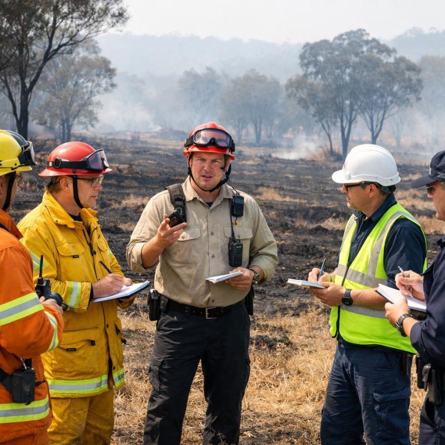
The aim is not for every person to stare at the same screen. It is for incident-management functions and field resources to work from a sufficiently consistent understanding of what is happening, what may happen next, what resources are available and what the priorities are.
This becomes especially important at complex incidents involving fire agencies, police, ambulance, councils, utilities, aviation, land managers, health services and interstate or national support.
Preparation: analytics before the emergency
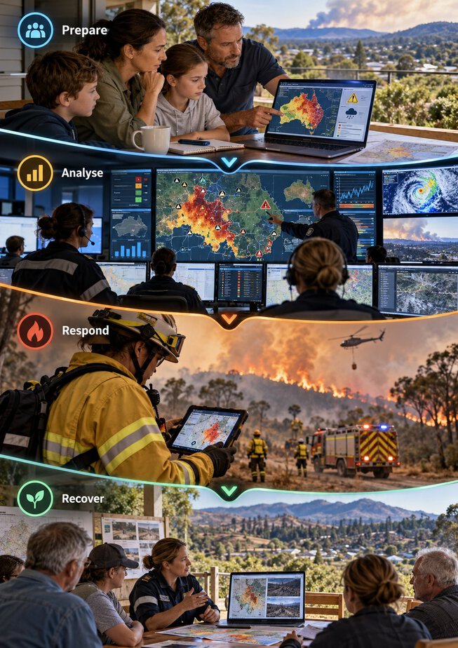
Some of the most valuable analysis happens before an incident starts. Historical callouts, vegetation and fuel information, previous flood extents, infrastructure failures, population data, weather patterns and resource availability can expose vulnerabilities before they become operational problems.
A brigade or emergency organisation might analyse response times, recurring incident locations, equipment failures, fatigue trends or seasonal workload. A council might combine hazard mapping with roads, aged-care facilities, schools and critical infrastructure. A business might examine outage history, supplier dependency and staff travel risk.
For households, the same principle can be applied much more simply: know the hazard around your home, understand your warning sources, identify routes and backup routes, and decide triggers before stress and time pressure affect judgement. That is good evidence-based planning, even though it is not formal agency “business intelligence”.
Response: combining live information under pressure
During an incident, information may arrive from dispatch systems, crews, aircraft, weather stations, incident maps, police, utilities, local government, community reports and social media. The problem quickly becomes one of quality and prioritisation, not just quantity.
The Bureau of Meteorology provides fire-weather warnings, Fire Danger Ratings, observations, forecasts and specialised products. Fire agencies combine these inputs with fuel conditions, local knowledge and field intelligence when making operational decisions.
In Victoria, VicEmergency brings incidents, warnings and map layers together for public use. Its map can show warning areas, incident areas, Fire Danger Ratings, wind information and rain radar. But VicEmergency also warns that an incident-area display represents an area at a point in time and may not reflect the current extent of an incident.
That is an important analytics lesson
Every map layer needs context: Who produced it? When was it updated? Is it observed, forecast or modelled? What does it leave out? A beautifully designed dashboard can still mislead if those questions are ignored.
National coordination: turning information into consequence management
At a national level, NEMA’s National Coordination Mechanism provides a useful example of shared situational awareness. It can bring together Australian, state, territory and local government officials along with industry, not-for-profit organisations and expert advisers.
NEMA describes the mechanism as a way to share situational awareness, rapidly define problems and coordinate consequence management. That last point is important: the question is not only “where is the hazard?” It can also be “what will this do to electricity, transport, food supply, telecommunications, health services or vulnerable communities?”
Good intelligence therefore looks beyond the fire perimeter or flood line and considers second- and third-order effects.
Maps, satellites and geospatial intelligence
Geospatial information is one of the most powerful forms of emergency intelligence because many operational questions are geographic: where is the hazard, who is exposed, what roads remain open, where are crews, and what assets may be threatened next?
Geoscience Australia’s Digital Earth Australia uses satellite imagery and spatial data to support hazard planning, response and recovery. Its emergency-management work can contribute to fire-risk indicators, land-cover mapping, flood and fire impact assessment and broader situational awareness.
Satellite products are particularly valuable when an event covers a very large area, but they also have limitations. Cloud, smoke, satellite revisit time, processing delay and resolution can affect what is visible and how quickly information becomes operationally useful.
Warnings are intelligence translated into public action
A public warning is not simply a data dump. The Australian Institute for Disaster Resilience states that effective warnings should be timely, targeted and tailored, and should come from trusted, authoritative sources that can be verified.
This is where good analytics meets good communication. The public usually does not need to see every model run, sensor reading and operational discussion. They need clear answers to questions such as: What is happening? Where? When? What does it mean for me? What should I do now?
Australia has also introduced AusAlert, the national cell-broadcast warning system. Official government material states the system became ready for use from 1 October 2026. It can send emergency messages to compatible devices within a defined area using active 4G and 5G mobile networks.
AusAlert adds another warning pathway; it does not make other sources unnecessary. People should continue using official emergency websites and apps, emergency broadcasters and instructions from the responsible authority.
The five biggest data traps during emergencies
- Stale information. A map can be accurate when published and wrong ten minutes later.
- False precision. A sharp line on a screen may imply certainty that the underlying forecast or observation does not have.
- Single-source dependence. One sensor, report or social-media post should not automatically become accepted fact.
- Confirmation bias. People naturally notice information that supports the picture they already believe. Intelligence processes need to actively test assumptions.
- Information overload. More layers, alerts and charts can make decisions worse if critical information is buried.
Good emergency intelligence therefore values relevance, reliability and timing more than the number of data feeds connected to the dashboard.
AI, predictive analytics and automation
Predictive models can help estimate fire spread, flood extent, demand, travel time or likely consequences. Artificial intelligence may also help classify imagery, identify patterns or summarise large volumes of information.
These tools can improve speed, but emergency decisions need transparency about limitations. Models depend on assumptions and input data. A system can be technically sophisticated and still produce a poor answer if the incoming data is incomplete, delayed or wrong.
The safe approach is decision support, not decision replacement. The responsible commander or authority still needs doctrine, local knowledge, field reports, uncertainty and safety margins.
Recovery: analytics after the sirens stop
Once immediate response begins to wind down, the questions change. Which homes are damaged? Which roads, schools or health services remain disrupted? Who has been displaced? Which communities need welfare, housing, financial or mental-health support?
Recovery intelligence can combine damage assessments, service restoration, community needs, grant demand, demographic information and infrastructure status. AIIMS 2025 gives recovery a stronger connection to incident management, reinforcing that the handover from response should be planned rather than treated as an afterthought.
For communities and businesses, recovery data can also reveal where resilience investment should go before the next event.
Lessons management: analytics that actually changes something
The Australian Disaster Resilience Lessons Management Handbook describes a structured approach to collecting, analysing and sharing lessons. A useful after-action review is therefore more than asking people whether the incident “went well”.
Evidence might include logs, timelines, radio records, decisions, resource movements, safety events, warnings, public feedback and performance data. The aim is to identify patterns and convert them into improvement.
The important step is implementation. If an organisation identifies the same communications failure after three incidents but never assigns an action, owner or completion date, it has collected observations — it has not learned the lesson.
What a useful emergency dashboard should tell you
| Question | Useful information |
|---|---|
| What is happening? | Confirmed incident type, location, size, behaviour and current impacts. |
| What may happen next? | Forecast weather, modelling, likely consequences and uncertainty. |
| Who or what is exposed? | People, towns, roads, utilities, hospitals, schools and critical infrastructure. |
| What resources do we have? | Crews, appliances, aircraft, machinery, relief teams and specialist capability. |
| How confident are we? | Source, timestamp, data gaps, assumptions and information still requiring validation. |
Practical advice for households and businesses
You do not need specialist BI software to make better emergency decisions. A household or small business can use the same basic discipline on a smaller scale:
- Use official weather, warning and emergency sources.
- Decide in advance which information will trigger action.
- Keep a second information source in case mobile data or power fails.
- Know when the information was last updated.
- Do not rely on social media screenshots without checking the original authority.
- Keep essential contacts, plans and routes available offline.
- After an emergency or exercise, record what failed and change the plan.
Operational perspective
From a fireground perspective, the most useful intelligence is often information that changes a decision. A ten-page report may be less valuable than a verified message that a bridge is no longer trafficable, the wind change is thirty minutes earlier than expected, a crew has lost water supply or a community is evacuating onto the planned appliance access route.
Experienced firefighters also know that local knowledge can expose problems that are invisible on a statewide map. A track may exist in the database but be unusable for a heavy appliance. A water point may be marked but dry. Mobile coverage may disappear behind a ridge.
The strongest system combines technology with trained people who question the information, validate it and understand the operational consequences.
Frequently asked questions
Is business intelligence an official AIIMS function?
Not by that name. AIIMS 2025 uses functions and concepts including Intelligence, Planning and Public Information. “Business intelligence” is useful as an everyday umbrella term for turning data into decisions.
Can a dashboard tell an Incident Controller what to do?
It can support the decision by presenting information and analysis. Responsibility still sits with the authorised decision-maker using doctrine, risk controls, local knowledge and current field information.
Why can two emergency maps look different?
They may use different sources, update times, definitions or modelling methods. Always check the issuing authority, timestamp and map legend before comparing them.
Should the public rely on social media for emergency intelligence?
Social media can provide useful observations, but safety decisions should be checked against official warnings and authoritative sources.
What is the simplest analytics habit after an emergency?
Write down what happened, what worked, what failed, what evidence supports the conclusion and what specific change will be made before the next event.
The key message
Collect it. Validate it. Understand the uncertainty. Share a clear picture. Make the decision. Then learn from what happened.
Related FireRescue guides
- AFAC — AIIMS 2025
- NEMA — National Coordination Mechanism
- Bureau of Meteorology — Fire weather services
- VicEmergency — Incidents and warnings
- Geoscience Australia — Digital Earth Australia emergency management
- AIDR — Public Information and Warnings Handbook
- AIDR — Lessons Management Handbook
- AusAlert — About Australia’s national warning system
Ken Walker — former Station Officer and fire-service educator with career and volunteer firefighting experience.
This guide combines current Australian emergency-management doctrine and official data sources with an operational firefighting perspective. It distinguishes formal incident intelligence from general public information and treats analytics as decision support rather than a replacement for authorised command judgement.
Safety disclaimer
This article is general educational information. It is not live incident intelligence and does not replace warnings, operational procedures, agency doctrine or directions from emergency authorities. During an emergency, use current official information and follow the instructions issued for your location.
FireRescue Training Hub
Access practical fire and emergency study support resources, downloads, checklists, audio guides, and member-only course content.
- Course library
- PDF downloads
- Audio guides
- Checklists
Study support only. Not accredited training or a replacement for workplace procedures.
About the author and safety review
Ken Walker
Former Station Officer and fire service educator
Former career firefighter with extensive career and volunteer fire service experience.
Qualifications: Associate Diploma of Applied Science in Fire Technology; Institute of Fire Engineers studies.
Author profilehttps://www.firerescue.com.au/about-us/