Key Takeaways
Firefighter tracking in low-visibility conditions relies on clear communication, trusted technology, and coordinated team efforts. Understanding the unique challenges of smoke-filled or dark environments is critical to reducing risks during emergency response.
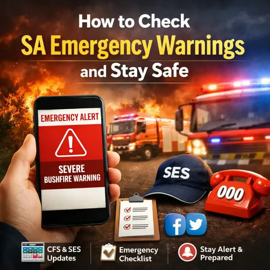
Australian emergency services use a range of tracking tools and protocols that complement each other, improving safety and operational effectiveness. Always follow official agency procedures and local warnings to stay safe in these situations.
Understanding the Challenges of Firefighter Tracking in Low-Visibility Conditions
Firefighters face some of their toughest challenges when operating in environments with low visibility, such as thick smoke, heavy fog, or complete darkness. These conditions can quickly disorient personnel, making it difficult to maintain awareness of their exact location or the position of team members. This not only increases the risk of injury or entrapment but also hampers effective firefighting operations.
In Australia, fire agencies like Fire and Rescue NSW, the Country Fire Authority (CFA) in Victoria, and other state services have developed procedures and technologies to improve tracking and safety. These efforts help teams maintain situational awareness even when visual cues are minimal or absent.
The nature of smoke itself presents a dynamic challenge. Smoke density can vary rapidly and unpredictably, often influenced by changes in wind direction and fuel load. This means that visibility can deteriorate suddenly, trapping firefighters in zero-visibility zones. Compounding this is the intense heat that can cause physical stress and impair cognitive function, making navigation and communication even more difficult.
Moreover, the structural integrity of buildings or terrain in wildfires can be compromised, creating hazards such as collapsing walls or unstable footing. In such scenarios, traditional visual tracking methods are insufficient, and reliance on technology and procedural discipline becomes paramount to ensure firefighter safety.
Technology and Tools Supporting Tracking in Low Visibility
Personal Location Beacons and Radios
Many Australian fire services equip firefighters with personal location beacons and radios that enable commanders to monitor positions remotely. These devices transmit location data even when GPS signals may be unreliable inside buildings or dense bushland. Radios remain a vital communication link, and some models now integrate GPS tracking, allowing teams to update positions in real time.
The evolution of these devices includes the integration of inertial navigation systems that can track movement indoors without GPS, using accelerometers and gyroscopes to estimate position changes. This technology helps maintain location awareness even when external signals are lost. Additionally, wearable devices are becoming more compact and robust, designed to withstand extreme heat and moisture encountered during firefighting operations.
Thermal Imaging Cameras
Thermal imaging cameras help firefighters see through smoke and darkness by detecting heat signatures. While primarily a search and rescue and firefighting tool, thermal cameras also assist in tracking team movement when combined with clear communication protocols. Thermal images can be shared with command units to confirm a firefighter’s location during operations.
Recent advancements have led to the development of wearable thermal sensors that provide real-time heat maps accessible via command centre displays. These tools not only aid in navigation but also warn of dangerous temperature increases that might indicate flashover or structural collapse risks. The ability to overlay thermal data on building blueprints or maps enhances situational awareness for commanders managing complex incidents.
Tracking Software and Incident Management Systems
Modern incident management software used by Australian agencies integrates data from various tracking devices to provide a consolidated view of personnel locations. This helps incident commanders make informed decisions about resource deployment and firefighter safety, especially in complex, low-visibility environments.
These systems often incorporate geofencing capabilities, alerting commanders if firefighters move into hazardous zones or exit designated safe areas. Integration with mapping tools and real-time environmental sensors allows for dynamic updates that reflect changing fire behaviour and environmental conditions. Furthermore, cloud-based platforms enable multi-agency coordination, ensuring that police, ambulance, and SES units have access to vital location data during joint operations.
Low-Visibility Fireground Risk Snapshot
This visual uses publicly reported fire-service injury patterns as a practical evidence base for content about firefighter tracking, smoke, visibility, situational awareness and crew safety.
Pie Chart: Fireground Injury Symptoms
Average distribution of key non-fatal fireground injury symptoms. The large smoke-inhalation share supports why tracking, communication and low-visibility control matter so much during interior and smoke-heavy incidents.
Inhalation
Symptom Breakdown
Key Details Below the Chart
Average yearly fireground injuries
NFPA estimated an average of 20,480 non-fatal fireground injuries per year across 2020–2024.
Fire development factors
Factors linked to fire development, including smoke conditions, were involved in 57% of fireground injuries.
Situational awareness link
A NIOSH report cites NIST research stating 40% of firefighter injuries are attributed to situational awareness.
Line-of-duty death relevance
The same NIOSH-cited research says situational awareness and human error contribute to nearly 20% of fireground line-of-duty deaths.
Lost or disoriented deaths
USFA recorded 3 firefighter deaths in 2021 from becoming lost or disoriented inside burning structures.
Practical Procedures for Tracking Firefighters Safely
Tracking in low-visibility conditions is never solely about technology. It starts with strong procedural foundations. Firefighters are trained to move in teams, maintain physical contact or visual signals where possible, and use consistent communication methods. Accountability systems such as entry control logs and personnel tracking boards ensure that commanders know who is inside hazardous areas at any time.
In addition, Australian fire agencies emphasise the importance of clear call signs and regular radio check-ins. Situations can change rapidly, so maintaining communication helps detect if a firefighter is in trouble or lost. Incident Safety Officers monitor conditions closely and can initiate emergency response protocols if tracking indicates a problem.
Another critical procedural element is the use of rapid intervention teams (RITs) or firefighter rescue teams. These teams are specifically designated to respond immediately to any distress signals or tracking alerts indicating a firefighter may be trapped or incapacitated. Their presence ensures that assistance is ready without delay, significantly improving the chances of a successful rescue.
Training drills regularly simulate low-visibility scenarios, reinforcing the importance of maintaining contact and communication discipline. Firefighters practice using tactile signals, such as rope tugs or hand signals, when radios fail or are impractical. This combination of technological and procedural preparedness forms the backbone of safe operations in challenging environments.
Environmental and Situational Factors to Consider
Australian firefighters often operate in challenging environments such as remote bushland, urban high-rises, and industrial sites. Each setting presents unique tracking challenges. Thick eucalyptus smoke, extreme heat, and rugged terrain can affect device reliability and human performance.
Weather conditions, including wind shifts or heavy rain, also impact visibility and communication. Planning for these variables is essential. Incident controllers incorporate weather forecasts and on-the-ground observations to adjust tracking strategies and ensure personnel safety.
Within urban environments, factors such as building layout complexity, presence of hazardous materials, and electrical hazards require specialized considerations. High-rise fires demand vertical tracking capabilities, where firefighters may be several floors above the ground. In these cases, tracking systems must reliably transmit signals through multiple building layers and interference.
In bushfire scenarios, dense vegetation and uneven terrain can obstruct radio signals and GPS accuracy. Firefighters must therefore rely on a combination of mapping, compass navigation, and periodic check-ins to maintain orientation. The unpredictable nature of wildfires, with rapidly changing fire fronts and ember attacks, further complicates tracking efforts.
Psychological stress and physical fatigue also influence tracking effectiveness. Firefighters under extreme stress may forget protocols or fail to report location changes promptly. Agencies address this by rotating crews regularly and monitoring vital signs where possible, ensuring that personnel remain capable of adhering to tracking procedures.
If You Only Do Five Things for Firefighter Tracking
First, always maintain clear, regular communication with your team and command. Radios should be checked often, and agreed call signs used correctly. This ensures messages are understood and location updates are timely.
Second, work in pairs or teams so firefighters can rely on physical presence and support if visibility drops. This team cohesion reduces isolation risks and helps maintain situational awareness.
Third, use available technology such as personal location beacons and thermal imaging cameras as tools to complement, not replace, traditional safety methods. Technology enhances but does not substitute fundamental safety practices.
Fourth, always follow the procedures and advice of your local fire service and incident commanders, including adherence to accountability systems. These are developed from extensive experience and are designed to manage risk effectively.
Finally, be prepared and aware of environmental factors that can affect tracking, such as smoke density, weather changes, and terrain complexity. Anticipating these challenges allows for proactive adjustments to tracking strategies and enhances overall safety.
Incorporating these five principles into daily operations creates a strong foundation for maintaining firefighter safety in even the most challenging low-visibility conditions.
Who Does What in Australia: Fire/Rescue, Police, Ambulance & SES
Fire and Rescue services in Australia respond to fires, hazardous incidents, and rescues. They lead firefighting efforts and manage on-scene safety, including firefighter tracking in low-visibility conditions.
Police support emergency scenes by securing areas and managing public safety. They may assist in coordinating emergency responses, especially during large incidents. Their role can include traffic control, evacuation coordination, and crime scene preservation when applicable.
Ambulance services provide medical support and treatment for injured persons. They coordinate with fire services to ensure rapid care for firefighters or civilians harmed during incidents. Advanced life support capabilities and triage protocols are critical in mass casualty scenarios.
The State Emergency Service (SES) specialises in storm, flood, and other natural disaster responses, often supporting fire agencies with rescues and logistics when conditions are complex. SES volunteers frequently assist with community warnings, damage assessment, and temporary shelter operations.
In life-threatening emergencies, call 000 immediately for assistance.
Collaboration between these agencies is essential during complex incidents. Joint training exercises and interoperable communication systems help ensure seamless coordination when multiple services respond simultaneously. This integrated approach enhances overall incident management and firefighter safety, particularly in low-visibility and high-risk environments.